Intelligence experts have raised the possibility that Iran has been given access to China’s BeiDou satellite navigation system and could be using it to improve the precision of its missile strikes, reflecting closer technological cooperation between Tehran and Beijing.

Intelligence experts suggest that Iran may be relying on a Chinese satellite navigation system to target Israeli and US military assets in the Middle East.
Former French foreign intelligence chief Alain Juillet told France’s independent Tocsin podcast this week that Iran has likely been given access to China’s BeiDou navigation system, citing the noticeable improvement in Iran’s targeting accuracy since the 12-day conflict with Israel in June.
One of the surprising developments in this conflict is the improved accuracy of Iranian missiles compared to the war eight months ago, raising questions about the guidance systems used,” said Alain Juillet, who led intelligence at France’s General Directorate for External Security from 2002 to 2003, during an interview with Tocsin.
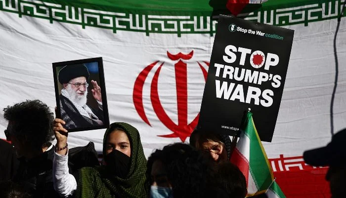
In retaliation for the US-Israeli attacks that began on February 28 and the killing of senior Iranian figures, including Supreme Leader Ali Khamenei, Iran has fired hundreds of ballistic missiles and drones at Israel and US installations in Gulf countries.
While Israel and Gulf nations have intercepted many of the projectiles, several have penetrated their defences, resulting in significant damage and casualties.
While the US can jam or restrict access to its government-owned Global Positioning System (GPS), which Iran’s military has previously relied on, it has limited ability to interfere with China’s BeiDou system if Iran is indeed using it. Iran has neither confirmed nor commented on these reports.
Here’s what is known about BeiDou and why Iran’s potential use of the system could challenge the US monopoly on real-time satellite intelligence on the battlefield.
What is the BeiDou Navigation Satellite System (BDS)?
China launched the latest version of its satellite navigation system, designed to rival GPS, in 2020. President Xi Jinping officially inaugurated the system during a July 2020 ceremony at the Great Hall of the People in Beijing.
The project began after the 1996 Taiwan crisis, as China feared that the US might restrict access to GPS in the future.
According to the official BeiDou website, the system’s goal is to “serve the world and benefit mankind.”
Importantly, China’s BeiDou system operates with significantly more satellites than other global navigation networks. Data from Al Jazeera’s AJ Labs team shows that while the US GPS system has 24 satellites, BeiDou relies on 45. Other major navigation systems—Russia’s GLONASS and the EU’s Galileo—each operate with 24 satellites.
According to the official BeiDou website, the system is divided into three segments: space, ground, and user.
“The BDS ground segment consists of various ground stations, including master control stations, time synchronization/uplink stations, monitoring stations, as well as operation and management facilities for the inter-satellite link,” the website explains.
The BDS user segment includes a range of basic products, systems, and services compatible with other navigation systems, such as chips, modules, antennas, terminals, application systems, and application services.”
Like other satellite navigation systems, BeiDou provides global coverage by sending timing signals from its satellites to receivers on the ground or in vehicles. By calculating the time it takes for signals from multiple satellites to reach a receiver, the system can determine an accurate geographic position.
“Accuracy depends on the service level,” said Brussels-based military and political analyst Elijah Magnier. “The open civilian signal typically offers positioning accuracy of about five to 10 metres, while restricted services for authorised users can achieve far greater precision.”
Could Iran be using BeiDou?
Iran has not confirmed reports of using the system. It also remains uncertain whether the country could fully switch its military operations to a different satellite navigation network in the short period since last year’s June conflict with Israel.
After that war, Iran’s Ministry of Information and Communications Technology stated that the country “uses all existing capacities in the world and does not rely on a single source of technology.”
However, Alain Juillet told Tocsin that adopting China’s BeiDou system could plausibly explain the marked improvement in Iran’s missile targeting since last year.
“There is discussion about replacing the GPS system with a Chinese system, which accounts for the precision of Iranian missiles… significant targets have been struck,” he said.
Some analysts suggest that Iran has been working to integrate China’s navigation systems for far longer than the past eight months.
Theo Nencini, an expert on China‑Iran relations and research fellow at the ChinaMed Project, told Al Jazeera:
“Back in 2015, Iran reportedly signed a memorandum of understanding to integrate BeiDou‑2 into its military infrastructure—particularly to enhance missile guidance using signals far more precise than the civilian GPS system its armed forces had relied on.”
Analysts say the implementation was gradual but accelerated after the Sino‑Iranian Comprehensive Strategic Partnership was signed in March 2021, when China is believed to have granted Iran access to BeiDou’s encrypted military signals.
“From that point, the Iranian military began incorporating BeiDou into missile and drone guidance systems, as well as certain secure communication networks,” Nencini added.
In practice, this shift meant that Iran began gradually phasing out reliance on the US GPS around 2021.
“Some analysts had already suggested that BeiDou played a central role in the first wave of Iranian missile strikes against Israel in April 2024, given the remarkable precision of those attacks,” Nencini noted.
However, Iran is believed to have fully transitioned to BeiDou by June 2025, including for civilian applications such as transportation and logistics. This came shortly after the 12-day conflict, during which GPS disruptions affected the guidance of Iranian missiles and drones, as well as civilian aircraft and shipping.
“Iran’s adoption of BeiDou reflects longstanding concerns and demonstrates its awareness of the technological demands shaping future battlefields,” Theo Nencini said. “The 12-day war served as a clear turning point, prompting Tehran to accelerate the complete transition last year.”
How could using BeiDou improve targeting accuracy?
The BeiDou system could enable Iran to guide its ballistic missiles with far greater precision than before.
Elijah Magnier explained that Iranian missiles and drones have largely relied on inertial navigation systems (INS) until now. “These systems determine a weapon’s position by measuring acceleration and motion through onboard sensors such as gyroscopes and accelerometers. Inertial navigation has the advantage of being self-contained and resistant to external interference,” he told Al Jazeera.
“However, INS has a major limitation: small measurement errors accumulate over time and distance, gradually reducing accuracy. Satellite navigation signals, such as those from BeiDou, help overcome this problem.”
Elijah Magnier added, “Typically, a missile relies on inertial navigation to follow its general trajectory, while satellite signals are used to fine-tune its path and improve targeting precision. This combination leads to a significant boost in accuracy.”
He noted that it would be logical for Iran to use multiple navigation systems rather than relying on just one.
“Using several satellite systems simultaneously offers a key advantage: resilience against jamming or signal disruption,” he explained. “In contested environments, navigation signals can be deliberately interfered with. If a weapon depends on a single system, any disruption can reduce accuracy. But guidance systems that can receive signals from multiple constellations are far less vulnerable to complete navigation denial. Additionally, access to more satellites improves signal geometry, further enhancing positional accuracy.”
Analysts say the Chinese system is extremely precise, with a margin of error of less than one metre (3.3 ft), and can automatically adjust target directions if they move. “This is far more accurate than what was achievable with the civilian GPS signal, as the US restricts its encrypted military signals from adversaries,” Theo Nencini told Al Jazeera.
Moreover, BeiDou could help Iran bypass the Western jamming systems that Israel used during last year’s 12-day war. In 2025, Israeli forces successfully disrupted Iranian drones and missiles that relied on GPS signals, using techniques such as feeding false coordinates to incoming devices. The BeiDou system, however, can filter out such interference.
Military analyst Patricia Marins told bne IntelliNews this week: “Unlike civilian-grade GPS signals, which were disabled in 2025, BDS‑3’s military-tier B3A signal is essentially unjammable.”
She added that the system employs “complex frequency hopping and Navigation Message Authentication (NMA), which prevents ‘spoofing.’”
BeiDou also features a short-message communication system that enables operators to stay in contact with drones or missiles up to 2,000 km (1,240 miles) away while in flight. This capability allows weapons to potentially be redirected after launch, Patricia Marins explained.
How significant is Iran’s use of BeiDou?
If Iran does have access to BeiDou, analysts say it could be a game-changer.
“The evolution of satellite navigation has reshaped modern warfare,” Elijah Magnier said. “Precision strike capability, once limited to a few advanced militaries, is now increasingly determined by access to global navigation infrastructure. As long-range weapons become more accurate and resistant to interference, systems like BeiDou will play a major role in the technological foundation of contemporary conflict.”
Theo Nencini added that if BeiDou’s effectiveness is confirmed, it could prompt Iran’s neighbours—including countries currently targeted by Iranian missiles—to rethink their dependence on GPS. “Over time, this could lead to a shift in regional satellite navigation architecture toward a more diversified and less US-centric system.”
The ongoing conflict could also give China—“which is certainly gathering military intelligence through its surveillance satellites,” Theo Nencini said—a chance to field-test its guidance systems in a large-scale operational theatre like the current Middle Eastern war, which directly involves the US.
“This conflict allows China to evaluate the performance of its systems against American fifth-generation fighter jets such as the F‑35, while also collecting valuable data on the US capability to intercept Iranian missiles and drones guided by BeiDou,” Nencini added.
Estimates suggest that Iran possesses one of the largest ballistic missile arsenals in the Middle East, though exact numbers aren’t publicly confirmed. Open‑source assessments from intelligence and defence analysts indicate:
- Iran’s stockpile likely includes several thousand ballistic missiles, with many estimates placing the total at around 3,000 or more. These include a mix of short‑range and medium‑range missiles capable of striking targets across the region.
- The arsenal comprises a variety of systems such as Shahab, Sejjil, Emad, Ghadr, and Khorramshahr missiles, most with ranges from a few hundred to about 2,000 km or more.
- Some assessments even suggest Iran could expand its inventory further in coming years, potentially reaching 5,000 missiles by 2027 if production continues at current rates.
Because detailed military inventories are classified, all figures are approximate, but analysts agree Iran’s ballistic missile force is the largest and most diverse in the region
Alain Juillet told the Tocsin podcast that, although Israeli and US air forces claim to have destroyed all identifiable targets in Iran, the exact number and location of Iranian missiles remains unknown.
“Iran is three times the size of France, and its missiles are mounted on trucks dispersed across the country. How can one track these trucks in such a vast area?” he said.
Juillet added that Iran is likely deploying its missiles more strategically than during the 12-Day War, anticipating that the current conflict could be prolonged.
Meanwhile, US officials are concerned that their stock of expensive interceptor missiles could be depleted while intercepting relatively cheap Iranian Shahed drones, even before Iran has to deploy many ballistic missiles.
To address this, the Trump administration reportedly asked Ukraine—where Russia has been using Iranian-made Shahed drones—to share the interceptor technology it has developed and mass-produced.